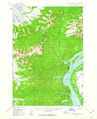
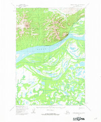
1952 Map of Russian Mission D-7
USGS Topo · Published 1962About this map
The Yukon River dominates this mid-century interior landscape, winding past a series of large islands and dramatic landmarks like Bareface Bluff. During the early 1950s, the region supported specialized activities including extraction at the Kako Mine and transport at Kako Landing. A critical transportation link is documented via the Yukon-Kuskokwim Portage, alongside a Winter Trail that provided seasonal access across the frozen terrain. Evidence of shifting habitation is clear, with Russian Mission marked as abandoned, while nearby Nunvotchuk and Nunvotchuk Lake remain identified settlements. The geography is defined by the Kaiyuh Mountains to the north and a complex network of waterways, including the East Fork Kuyukutuk River and South Fork Kuyukutuk River, which drain into the main river valley.
Find a feature on this map
21 named features on this map. Tap any name to fly to it.
Don’t see what you’re looking for? This feature index may not catch every label — zoom into the map to look around manually.
Map Details
Editions of this 1952 Russian Mission D-7 Map
2 editions found
Other maps of this area

1947 · Russian Mission
USGS Topo · 1:250,000

1950 · Russian Mission
USGS Topo · 1:250,000

1951 · Holy Cross
USGS Topo · 1:250,000

1951 · Holy Cross A-5
USGS Topo · 1:63,360

1952 · Holy Cross A-6
USGS Topo · 1:63,360

1952 · Holy Cross
USGS Topo · 1:250,000

1952 · Russian Mission C-8
USGS Topo · 1:63,360
1952 · Russian Mission C-7
USGS Topo · 1:63,360
1952 · Russian Mission D-8
USGS Topo · 1:63,360
1952 · Russian Mission D-6
USGS Topo · 1:63,360