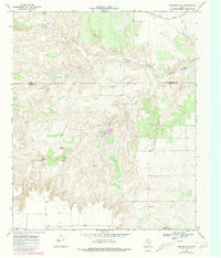
1968 Map of Rustler Camp
USGS Topo · Published 1981About this map
Tongue River (South Pease) carves through the high plains of West Texas, anchoring a landscape defined by seasonal drainages and remote ranching outposts. This 1968 survey, updated with 1979 revisions, highlights the isolated settlement of Rustler Camp situated near the headwaters of Rustler Creek. The area’s geography is shaped by the transition between the rolling breaks and the flatter tablelands, evidenced by the numerous springs such as Wolf Springs and unnamed Springs scattered near Grapevine Creek. Industrial activity in this sparsely populated region is represented by the Quanah Acme and Pacific railroad line crossing the northern reaches, alongside scattered evidence of local resource extraction like the Gravel Pit and isolated Oil Well sites. The boundary between Motley Co and Dickens Co runs through the heart of the quadrangle, marking a rugged territory where water sources like Mexican Creek were vital for both cattle and early inhabitants.
Find a feature on this map
17 named features on this map. Tap any name to fly to it.
Don’t see what you’re looking for? This feature index may not catch every label — zoom into the map to look around manually.
Map Details
Editions of this 1968 Rustler Camp Map
2 editions found
Other maps of this area

1954 · Lubbock
USGS Topo · 1:250,000

1965 · Wake
USGS Topo · 1:24,000

1966 · McAdoo
USGS Topo · 1:24,000

1967 · Dickens North
USGS Topo · 1:24,000

1967 · Haystack Mountain
USGS Topo · 1:24,000

1968 · Mac Bain
USGS Topo · 1:24,000

1968 · Roaring Springs
USGS Topo · 1:24,000

1968 · Rustler Camp
USGS Topo · 1:24,000
1968 · Dougherty
USGS Topo · 1:24,000

1968 · Afton
USGS Topo · 1:24,000