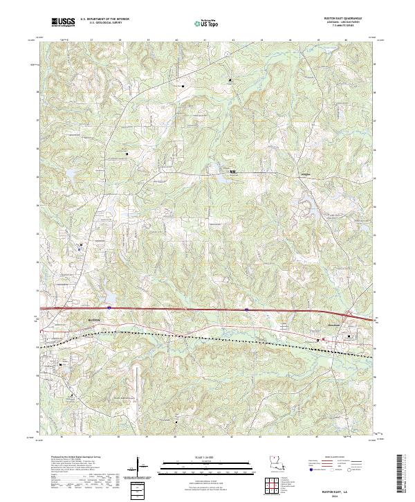
2024 Map of Ruston East
USGS Topo · Published 2024About this map
Ruston and the surrounding Lincoln Parish landscape are defined by a network of creeks and numerous historic burial grounds that reflect the long-standing community structure of the region. This modern topographic survey highlights the expansion of the area from the larger settlement of Ruston eastward toward Choudrant. The terrain is drained by several watercourses, including Choudrant Creek and Stowe Creek, which create the rolling topography characteristic of this part of Louisiana. Local history is deeply embedded in the land through family and community landmarks such as the George Washington Carver Cem, Zion Travler Cem, and Woods Chapel Cem. The inclusion of the Ruston Regional Airport and various parish roads, such as Mt Harmony Church Rd, illustrates the evolution of local infrastructure and its integration with the established rural settlements of Douglas and the surrounding townships.
Find a feature on this map
145 named features on this map. Tap any name to fly to it.
Don’t see what you’re looking for? This feature index may not catch every label — zoom into the map to look around manually.
Map Details
Editions of this 2024 Ruston East Map
This is the sole edition of this map. No revisions or reprints were ever made.
Other maps of this area

1950 · Ruston
USGS Topo · 1:62,500

1951 · Ruston
USGS Topo · 1:62,500

1952 · Calhoun
USGS Topo · 1:62,500

1953 · Chatham
USGS Topo · 1:62,500

1953 · Hodge
USGS Topo · 1:62,500

1955 · Shreveport
USGS Topo · 1:250,000

1956 · Shreveport
USGS Topo · 1:250,000
1982 · Downsville North
USGS Topo · 1:24,000
1982 · Eros
USGS Topo · 1:24,000
1982 · Downsville South
USGS Topo · 1:24,000