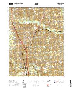
2019 Map of Ruther Glen
USGS Topo · Published 2019About this map
The Mattaponi River and North Anna River define the northern and southern reaches of this landscape near the border of Caroline and Hanover Counties. This area is characterized by a network of drainage systems including Reedy Creek, Polecat Creek, and Saddle Swamp, which supported historical milling operations like Colemans Millpond. Small crossroads communities and family settlements are scattered throughout, notably Ruther Glen, Golansville, and the interestingly named Signboard.
Find a feature on this map
93 named features on this map. Tap any name to fly to it.
Don’t see what you’re looking for? This feature index may not catch every label — zoom into the map to look around manually.
Map Details
Editions of this 2019 Ruther Glen Map
This is the sole edition of this map. No revisions or reprints were ever made.
Other maps of this area

1887 · Spottsylvania
USGS Topo · 1:125,000

1889 · Fredericksburg
USGS Topo · 1:125,000

1890 · Goochland
USGS Topo · 1:125,000

1892 · Fredericksburg
USGS Topo · 1:125,000

1892 · Spottsylvania
USGS Topo · 1:125,000

1892 · Goochland
USGS Topo · 1:125,000

1894 · Fredericksburg
USGS Topo · 1:125,000

1918 · Doswell
USGS Topo · 1:62,500

1942 · Bowling Green
USGS Topo · 1:31,680

1942 · Woodford
USGS Topo · 1:31,680