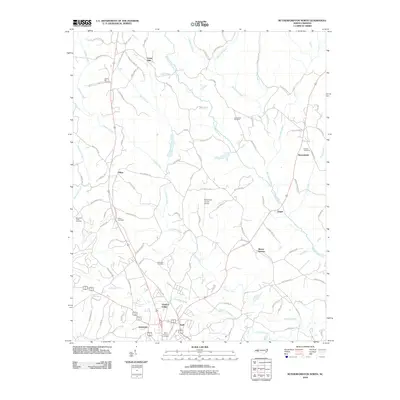
2010 Map of Rutherfordton North
USGS Topo · Published 2010About this map
Catheys Creek and the Second Broad River define the drainage patterns of this Rutherford County landscape, where small rural communities are connected by a network of winding roads like Old Union Mills Rd and Old Morganton Rd. The map illustrates a transition between agricultural lands and the growing aviation infrastructure at Rutherford County Airport near the center of the sheet. Local genealogy and history are anchored by numerous burial sites, including Gilboa Cemetery and Brittain Cemetery, which sit alongside established settlements such as Union Mills, Gilkey, and Logan. To the south, the clustered communities of Thermal Valley, Fernwood, and Ruth indicate more concentrated development near the foothills, while the northern reaches remain defined by creek branches and family-named ridges.
Find a feature on this map
98 named features on this map. Tap any name to fly to it.
Don’t see what you’re looking for? This feature index may not catch every label — zoom into the map to look around manually.
Map Details
Editions of this 2010 Rutherfordton North Map
This is the sole edition of this map. No revisions or reprints were ever made.
Other maps of this area

1900 · Mount Mitchell
USGS Topo · 1:125,000

1902 · Mount Mitchell
USGS Topo · 1:125,000

1905 · Morganton
USGS Topo · 1:125,000

1907 · Saluda
USGS Topo · 1:125,000

1953 · Charlotte
USGS Topo · 1:250,000

1954 · Charlotte
USGS Topo · 1:250,000

1955 · Knoxville
USGS Topo · 1:250,000

1957 · Knoxville
USGS Topo · 1:250,000

1959 · Lake Lure
USGS Topo · 1:62,500

1960 · Knoxville
USGS Topo · 1:250,000