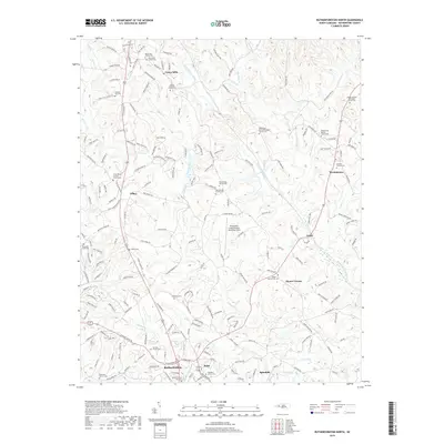
2019 Map of Rutherfordton North
USGS Topo · Published 2019About this map
Rutherfordton and its industrial neighbor Ruth anchor the southern portion of this landscape, situated just west of Spindale at the base of the Foothills. The area is defined by the winding course of the Second Broad River and its numerous tributaries, including Catheys Cr and Cherry Creek. This late-era survey documents a region where historic churchyards and rural settlements remain central to the local geography. Significant landmarks include the Rutherford County Airport-Marchman Field and an extensive network of cemeteries that serve as vital touchstones for genealogists, such as Brittain Church Cem and the Round Hill Church Cem near Union Mills. The map details the transition from the structured street grids of the southern towns to the scattered communities of Gilkey, Logan, and Westminster in the northern reaches.
Find a feature on this map
206 named features on this map. Tap any name to fly to it.
Don’t see what you’re looking for? This feature index may not catch every label — zoom into the map to look around manually.
Map Details
Editions of this 2019 Rutherfordton North Map
This is the sole edition of this map. No revisions or reprints were ever made.
Other maps of this area

1900 · Mount Mitchell
USGS Topo · 1:125,000

1902 · Mount Mitchell
USGS Topo · 1:125,000

1905 · Morganton
USGS Topo · 1:125,000

1907 · Saluda
USGS Topo · 1:125,000

1953 · Charlotte
USGS Topo · 1:250,000

1954 · Charlotte
USGS Topo · 1:250,000

1955 · Knoxville
USGS Topo · 1:250,000

1957 · Knoxville
USGS Topo · 1:250,000

1959 · Lake Lure
USGS Topo · 1:62,500

1960 · Knoxville
USGS Topo · 1:250,000