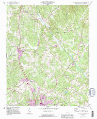
1993 Map of Rutherfordton North
USGS Topo · Published 1996About this map
Union Mills and Gilkey anchor this rural landscape in the 1990s, where the Second Broad River meanders through a terrain defined by small farming communities and numerous country churches. The map documents the southern expansion of development near Rutherfordton and Ruth, featuring the Rutherford County Airport and the Seaboard System railroad tracks that run north-south through the valley. This 1993 revision, based on earlier surveys, provides a detailed look at local genealogy landmarks such as The Bible Tabernacle, Brittain Ch, and the Ruth Sch. The network of secondary roads, including Nannytown Road and Whiteside Road, connects long-established settlements like Logan and Westminster, reflecting the persistent rural character of this portion of Rutherford County before further modern suburbanization.
Find a feature on this map
58 named features on this map. Tap any name to fly to it.
Don’t see what you’re looking for? This feature index may not catch every label — zoom into the map to look around manually.
Map Details
Editions of this 1993 Rutherfordton North Map
This is the sole edition of this map. No revisions or reprints were ever made.
Other maps of this area

1900 · Mount Mitchell
USGS Topo · 1:125,000

1902 · Mount Mitchell
USGS Topo · 1:125,000

1905 · Morganton
USGS Topo · 1:125,000

1907 · Saluda
USGS Topo · 1:125,000

1953 · Charlotte
USGS Topo · 1:250,000

1954 · Charlotte
USGS Topo · 1:250,000

1955 · Knoxville
USGS Topo · 1:250,000

1957 · Knoxville
USGS Topo · 1:250,000

1959 · Lake Lure
USGS Topo · 1:62,500

1960 · Knoxville
USGS Topo · 1:250,000