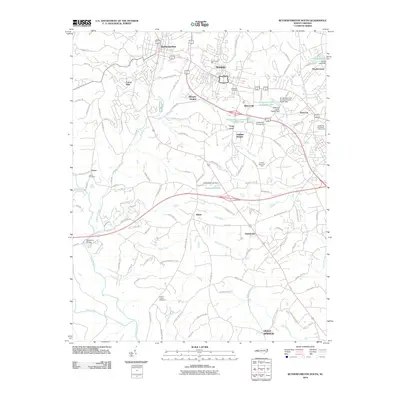
2010 Map of Rutherfordton South
USGS Topo · Published 2010About this map
The industrial and educational corridor between Rutherfordton and Spindale anchor this survey of Rutherford County. Stonecutter Mill stands as a primary landmark in Spindale, reflecting the area's manufacturing roots, while the campus of Isothermal Community College and its associated Isothermal Community College Lake occupy the central landscape. The terrain is defined by a dense network of tributaries including Cleghorn Creek, Grays Creek, and Floyds Creek, which eventually reach the southern boundary formed by the Broad River and Green River.
Find a feature on this map
117 named features on this map. Tap any name to fly to it.
Don’t see what you’re looking for? This feature index may not catch every label — zoom into the map to look around manually.
Map Details
Editions of this 2010 Rutherfordton South Map
This is the sole edition of this map. No revisions or reprints were ever made.
Other maps of this area

1907 · Saluda
USGS Topo · 1:125,000

1953 · Charlotte
USGS Topo · 1:250,000

1954 · Charlotte
USGS Topo · 1:250,000

1955 · Knoxville
USGS Topo · 1:250,000

1957 · Knoxville
USGS Topo · 1:250,000

1959 · Lake Lure
USGS Topo · 1:62,500

1959 · Cowpens
USGS Topo · 1:62,500

1960 · Knoxville
USGS Topo · 1:250,000

1960 · Charlotte
USGS Topo · 1:250,000

1961 · Inman
USGS Topo · 1:62,500