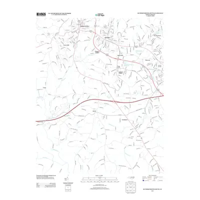
2013 Map of Rutherfordton South
USGS Topo · Published 2013About this map
Rutherfordton and Spindale anchor the northern reaches of this landscape, forming a corridor of development that transitions into the smaller communities of Ellington Heights, Bakersville, and Oakland Heights. The map highlights a significant educational and recreational hub centered around Isothermal Community College and the adjacent Isothermal Community College Lake, as well as the Forest City Municipal Golf Course to the east.
Find a feature on this map
36 named features on this map. Tap any name to fly to it.
Don’t see what you’re looking for? This feature index may not catch every label — zoom into the map to look around manually.
Map Details
Editions of this 2013 Rutherfordton South Map
This is the sole edition of this map. No revisions or reprints were ever made.
Other maps of this area

1907 · Saluda
USGS Topo · 1:125,000

1953 · Charlotte
USGS Topo · 1:250,000

1954 · Charlotte
USGS Topo · 1:250,000
1955 · Knoxville
USGS Topo · 1:250,000
1957 · Knoxville
USGS Topo · 1:250,000
1959 · Lake Lure
USGS Topo · 1:62,500
1959 · Cowpens
USGS Topo · 1:62,500
1960 · Knoxville
USGS Topo · 1:250,000

1960 · Charlotte
USGS Topo · 1:250,000
1961 · Inman
USGS Topo · 1:62,500