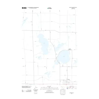
2013 Map of Ruthven
USGS Topo · Published 2013About this map
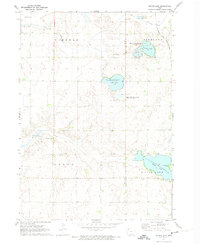
Lost Island Lake and the surrounding wetland complex dominate this northern Iowa landscape, where a intricate network of marshes and sloughs defines the terrain. The town of Ruthven is situated at the southern edge of the quadrangle, serving as a hub for the agricultural and recreational activity that characterizes the region. A dense grid of rural roads, such as 330th Ave and 300th St, organizes the territory between major water bodies like Trumbull Lake and Mud Lake. The presence of the Long Island Marsh Public Hunting Area and Barringer Slough highlights the importance of wildlife conservation and drainage management in this prairie pothole region. Small-scale water features, including Pickerel Run and Ditch Number 61, illustrate the historical and ongoing efforts to manage the local hydrology for both farming and natural preservation.
Find a feature on this map
41 named features on this map. Tap any name to fly to it.
Don’t see what you’re looking for? This feature index may not catch every label — zoom into the map to look around manually.
Map Details
Editions of this 2013 Ruthven Map
This is the sole edition of this map. No revisions or reprints were ever made.
Other maps of this area

1954 · Fairmont
USGS Topo · 1:250,000

1958 · Fairmont
USGS Topo · 1:250,000
1966 · Gillett Grove
USGS Topo · 1:24,000
1966 · Dickens
USGS Topo · 1:24,000
1970 · Spirit Lake SE
USGS Topo · 1:24,000
1972 · Graettinger West
USGS Topo · 1:24,000
1972 · Terril
USGS Topo · 1:24,000
1972 · Wallingford
USGS Topo · 1:24,000
1972 · Ayrshire
USGS Topo · 1:24,000
1972 · Silver Lake
USGS Topo · 1:24,000