
1972 Map of Terril
USGS Topo · Published 1974About this map
Terril serves as the central hub of this agricultural landscape in northwestern Iowa, situated at the junction of several civil townships including Richland, Lloyd, and Estherville. The town's layout is defined by its proximity to the Chicago and North Western railroad line, which cuts diagonally through the prairie. Local history is anchored at the Fairview Cem east of town, while the surrounding countryside is marked by a complex system of water management, including the engineered Ditch No 61 and Big Muddy Creek. To the east, the map reveals significant conservation efforts within the Cheever Lake State Game Management Area and Twelvemile Lake State Game Management Area, highlighting the region's commitment to preserving wetlands like Cheever Lake and Twelvemile Lake amidst the grain fields.
Find a feature on this map
19 named features on this map. Tap any name to fly to it.
Don’t see what you’re looking for? This feature index may not catch every label — zoom into the map to look around manually.
Map Details
Editions of this 1972 Terril Map
This is the sole edition of this map. No revisions or reprints were ever made.
Other maps of this area

1954 · Fairmont
USGS Topo · 1:250,000

1958 · Fairmont
USGS Topo · 1:250,000

1966 · Dickens
USGS Topo · 1:24,000

1970 · Spirit Lake SE
USGS Topo · 1:24,000

1970 · Spirit Lake
USGS Topo · 1:24,000

1972 · Graettinger West
USGS Topo · 1:24,000

1972 · Wallingford
USGS Topo · 1:24,000

1972 · Estherville
USGS Topo · 1:24,000
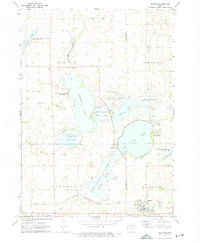
1972 · Ruthven
USGS Topo · 1:24,000
1972 · Superior
USGS Topo · 1:24,000