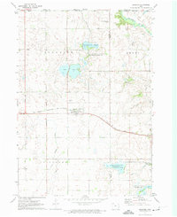
1972 Map of Superior
USGS Topo · Published 1974About this map
The town of Superior serves as a central hub in this early 1970s survey, situated along the line of the Chicago Rock Island and Pacific railroad. The landscape is defined by its glacial hydrology, featuring a dense network of sloughs and lakes that cross the Minnesota Iowa border. Significant natural features include the Swan Lake and Christopherson Slough areas, which were managed as part of a larger state game management system. Further south, the map details the courses of Muddy Creek and School Creek as they drain toward Fourmile Lake. A local burial site, Township Cem, is located just north of the Superior settlement, providing a point of interest for genealogists tracing local families during this era. The northeastern corner is clipped by the winding Des Moines River, marking the boundary between Jackson and Emmet counties.
Find a feature on this map
24 named features on this map. Tap any name to fly to it.
Don’t see what you’re looking for? This feature index may not catch every label — zoom into the map to look around manually.
Map Details
Editions of this 1972 Superior Map
This is the sole edition of this map. No revisions or reprints were ever made.
Other maps of this area

1954 · Fairmont
USGS Topo · 1:250,000

1958 · Fairmont
USGS Topo · 1:250,000

1970 · Jackson
USGS Topo · 1:24,000

1970 · Lakefield SE
USGS Topo · 1:24,000

1970 · Spirit Lake SE
USGS Topo · 1:24,000

1970 · Dunnell
USGS Topo · 1:24,000

1970 · Spirit Lake
USGS Topo · 1:24,000

1972 · Terril
USGS Topo · 1:24,000

1972 · Wallingford
USGS Topo · 1:24,000

1972 · Estherville
USGS Topo · 1:24,000