
1972 Map of Estherville
USGS Topo · Published 1974About this map
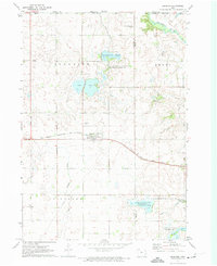
Estherville sits at the junction of the Des Moines River and a significant rail corridor in the early 1970s. The city's growth is marked by its concentration of institutions, including Iowa Lakes Community College, several medical facilities like Rosewood Manor Nursing Home, and the local Armory. To the west, the landscape transitions from the river valley to the protected woodlands of Fort Defiance State Park. The surrounding Emmet County countryside is heavily modified for agriculture, evidenced by an extensive drainage network including Ditch No 121 and Ditch No 29. Wildlife management areas such as Eagle Lake State Game Management Area and Cheever Lake State Game Management Area preserve significant wetland pockets amidst the grid of sections and gravel pits. Notable for genealogists are the many localized burial grounds, including the Norwegian Cem and St Patricks Cem.
Find a feature on this map
49 named features on this map. Tap any name to fly to it.
Don’t see what you’re looking for? This feature index may not catch every label — zoom into the map to look around manually.
Map Details
Editions of this 1972 Estherville Map
This is the sole edition of this map. No revisions or reprints were ever made.
Other maps of this area

1954 · Fairmont
USGS Topo · 1:250,000

1958 · Fairmont
USGS Topo · 1:250,000

1970 · Ceylon
USGS Topo · 1:24,000

1970 · Jackson
USGS Topo · 1:24,000

1970 · Dunnell
USGS Topo · 1:24,000

1972 · Terril
USGS Topo · 1:24,000

1972 · Wallingford
USGS Topo · 1:24,000
1972 · Superior
USGS Topo · 1:24,000

1980 · Ingham Lake
USGS Topo · 1:24,000

1980 · Gruver
USGS Topo · 1:24,000