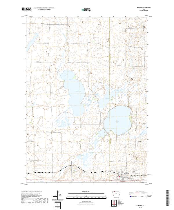
2022 Map of Ruthven
USGS Topo · Published 2022About this map
Ruthven sits at the southern edge of a glacial landscape defined by an intricate network of wetlands and open water. The town’s grid, featuring streets like Main St and Center St, is positioned near the intersection of Old Hwy 18 and 360th St, while local history is anchored at Crown Hill Cem and Calvary Cem to the east.
Find a feature on this map
37 named features on this map. Tap any name to fly to it.
Don’t see what you’re looking for? This feature index may not catch every label — zoom into the map to look around manually.
Map Details
Editions of this 2022 Ruthven Map
This is the sole edition of this map. No revisions or reprints were ever made.
Other maps of this area

1954 · Fairmont
USGS Topo · 1:250,000

1958 · Fairmont
USGS Topo · 1:250,000

1966 · Gillett Grove
USGS Topo · 1:24,000

1966 · Dickens
USGS Topo · 1:24,000

1970 · Spirit Lake SE
USGS Topo · 1:24,000

1972 · Graettinger West
USGS Topo · 1:24,000

1972 · Terril
USGS Topo · 1:24,000

1972 · Wallingford
USGS Topo · 1:24,000

1972 · Ayrshire
USGS Topo · 1:24,000
1972 · Silver Lake
USGS Topo · 1:24,000