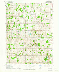
1962 Map of Rutland
USGS Topo · Published 1964About this map
Argos and the surrounding rural townships of Union, Green, Aubbeenaubbee, and Richland define this corner of Northern Indiana in the early 1960s. The landscape is a network of small agricultural settlements and community anchors, such as Richland Center and Rutland, connected by the New York Chicago and St Louis railroad line. An important historical boundary, the Old Indian Treaty Bdy, bisects the area, serving as a reminder of early 19th-century land divisions that preceded the modern county lines of Marshall Co and Fulton Co.
Find a feature on this map
28 named features on this map. Tap any name to fly to it.
Don’t see what you’re looking for? This feature index may not catch every label — zoom into the map to look around manually.
Map Details
Editions of this 1962 Rutland Map
2 editions found
Other maps of this area

1953 · Chicago
USGS Topo · 1:250,000

1957 · Chicago
USGS Topo · 1:250,000

1957 · Inwood
USGS Topo · 1:24,000

1957 · Plymouth
USGS Topo · 1:24,000

1958 · Donaldson
USGS Topo · 1:24,000

1962 · Pershing
USGS Topo · 1:24,000

1962 · Kewanna
USGS Topo · 1:24,000

1962 · Argos
USGS Topo · 1:24,000
1962 · Rochester
USGS Topo · 1:24,000

1962 · Culver
USGS Topo · 1:24,000