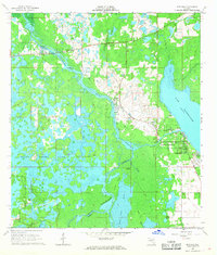
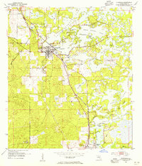
1967 Map of Rutland
USGS Topo · Published 1968About this map
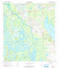
The Withlacoochee River forms a complex hydrologic network as it snakes through the marshlands of central Florida, marking the border between Citrus and Sumter counties. This 1960s landscape is defined by its seasonal wetlands and vast expanses of water, including the northern reaches of Tsala Apopka Lake and the western shore of Lake Panasoffkee. Small settlements like Rutland and Carlson sit near the river’s edge, while Panacoochee Retreats represents more modern residential development along the Outlet River. Local history is anchored by the Rutland Cem and the traces of an old Railroad Grade cutting through the terrain. The map documents an intricate environment of sloughs and islands, such as Kettle Island and Bear Island, revealing the difficult nature of permanent settlement in this riverine basin before significant modern drainage and infrastructure altered the flow of Jumper Creek and the surrounding prairies.
Find a feature on this map
25 named features on this map. Tap any name to fly to it.
Don’t see what you’re looking for? This feature index may not catch every label — zoom into the map to look around manually.
Map Details
Editions of this 1967 Rutland Map
2 editions found
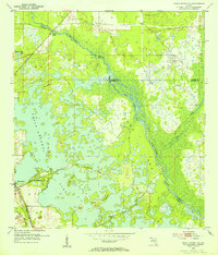
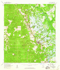
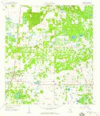
Other maps of this area

1893 · Panasoffkee
USGS Topo · 1:62,500

1895 · Tsala Apopka
USGS Topo · 1:62,500

1895 · Panasoffkee
USGS Topo · 1:62,500
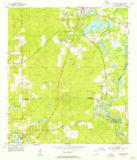
1954 · Nobleton
USGS Topo · 1:24,000
1954 · Tsala Apopka NE
USGS Topo · 1:24,000
1954 · Inverness
USGS Topo · 1:24,000
1954 · Inverness
USGS Topo · 1:62,500

1955 · Plant City
USGS Topo · 1:250,000

1958 · Plant City
USGS Topo · 1:250,000
1958 · Bushnell
USGS Topo · 1:24,000