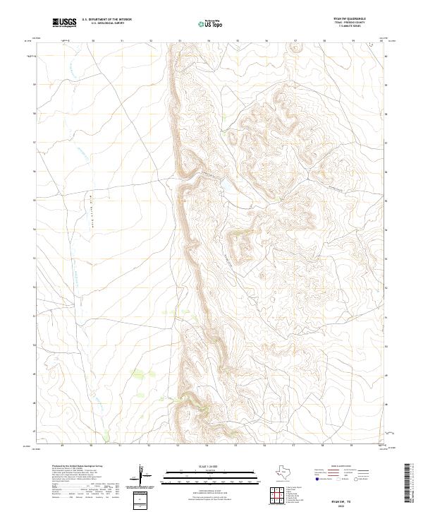
2022 Map of Ryan SW
USGS Topo · Published 2022About this map
Wild Horse Draw dominates the western half of this High Plains landscape, where intermittent drainage patterns trace a complex network across the high desert of Presidio County. The terrain transitions from relatively flat basins in the west to a labyrinth of deeply carved drainages and ridges in the eastern section. Human presence is sparse, defined primarily by the singular path of Richards Gate Rd, which navigates the shifting elevations between the plateaus. The topography is further marked by the winding course of Wild Horse Cr, illustrating the vital role of seasonal waterways in shaping this arid environment. This map offers a modern geospatial record of a remote region where traditional ranching access and natural hydrology remain the primary geographic features.
Find a feature on this map
3 named features on this map. Tap any name to fly to it.
Don’t see what you’re looking for? This feature index may not catch every label — zoom into the map to look around manually.
Map Details
Editions of this 2022 Ryan SW Map
This is the sole edition of this map. No revisions or reprints were ever made.
Other maps of this area

1895 · Marfa
USGS Topo · 1:125,000

1896 · San Carlos
USGS Topo · 1:125,000

1959 · Marfa
USGS Topo · 1:250,000

1965 · Marfa
USGS Topo · 1:250,000
1978 · Capote Peak
USGS Topo · 1:24,000
1979 · Nancy Anne Ranch
USGS Topo · 1:24,000

1979 · Capote Falls
USGS Topo · 1:24,000
1983 · Ryan
USGS Topo · 1:24,000
1983 · Cuesta Del Burro NW
USGS Topo · 1:24,000
1983 · Deer Peak
USGS Topo · 1:24,000