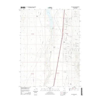
2014 Map of Rye Patch Dam
USGS Topo · Published 2014About this map
Rye Patch Dam controls the flow of the Humboldt River in this arid Nevada corridor, creating the expansive Rye Patch Reservoir that defines the northern landscape. This 2014 survey documents the modern intersection of hydraulic infrastructure and historic transport routes within the Humboldt Valley. The settlement of Rye Patch sits positioned along the western edge of the reservoir, surrounded by a complex network of residential roads including Topaz Lake LN and Chardonnay DR. Traces of the region's pioneering past remain visible in the alignment of the Old Emigrant Rd and the Old Victory Hwy, which parallel the modern interstate. To the south, the terrain becomes more dissected as the river winds through Rye Patch Canyon and past the mouth of Rocky Canyon, where the desert floor gives way to steep canyon walls and ephemeral drainages.
Find a feature on this map
68 named features on this map. Tap any name to fly to it.
Don’t see what you’re looking for? This feature index may not catch every label — zoom into the map to look around manually.
Map Details
Editions of this 2014 Rye Patch Dam Map
This is the sole edition of this map. No revisions or reprints were ever made.
Other maps of this area

1931 · Lovelock
USGS Topo · 1:250,000

1935 · Lovelock
USGS Topo · 1:250,000

1954 · Unionville
USGS Topo · 1:62,500

1955 · Lovelock
USGS Topo · 1:250,000

1956 · Oreana
USGS Topo · 1:62,500

1956 · Imlay
USGS Topo · 1:62,500

1959 · Lovelock
USGS Topo · 1:250,000

1971 · Rye Patch Reservoir South
USGS Topo · 1:24,000

1971 · Poker Brown
USGS Topo · 1:24,000

1984 · Lovelock
USGS Topo · 1:100,000