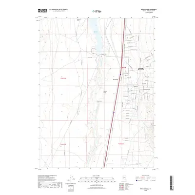
2018 Map of Rye Patch Dam
USGS Topo · Published 2018About this map
Humboldt River waters define this Pershing County landscape, pooling behind the Rye Patch Dam to form the sprawling Rye Patch Reservoir. This 2018 survey captures the intersection of historical travel routes and modern residential development, most notably at the Humboldt River Ranch and the small settlement of Rye Patch. The western corridor follows the ancient track of the Old Emigrant Rd through the Humboldt Valley, while the eastern side of the reservoir is marked by a dense grid of residential streets with names like New Exchequer Way and Titanium Ave. Topographically, the area is etched by steep drainages including Rocky Canyon and Wright Canyon, which descend toward the river bottom. The inclusion of the Old Victory Hwy further illustrates the layer of early 20th-century automotive history that follows the same natural path through the Great Basin as the wagon trains that preceded it.
Find a feature on this map
66 named features on this map. Tap any name to fly to it.
Don’t see what you’re looking for? This feature index may not catch every label — zoom into the map to look around manually.
Map Details
Editions of this 2018 Rye Patch Dam Map
This is the sole edition of this map. No revisions or reprints were ever made.
Other maps of this area

1931 · Lovelock
USGS Topo · 1:250,000

1935 · Lovelock
USGS Topo · 1:250,000

1954 · Unionville
USGS Topo · 1:62,500

1955 · Lovelock
USGS Topo · 1:250,000

1956 · Oreana
USGS Topo · 1:62,500

1956 · Imlay
USGS Topo · 1:62,500

1959 · Lovelock
USGS Topo · 1:250,000

1971 · Rye Patch Reservoir South
USGS Topo · 1:24,000

1971 · Poker Brown
USGS Topo · 1:24,000

1984 · Lovelock
USGS Topo · 1:100,000