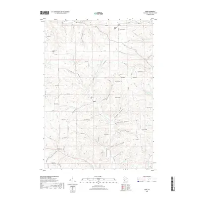
2018 Map of Sabin
USGS Topo · Published 2018About this map
Sabin and Bosstown anchor this survey of Richland County, where the landscape is defined by an intricate network of ridges and narrow hollows. The settlement pattern follows these high grounds, with Sylvan Ridge, English Ridge, and Hopewell Ridge serving as primary corridors for homesteads and travel. Local history is deeply embedded in the terrain, evidenced by numerous burial sites like Mount Tabor Cem near the town center and Mill Creek Cem further south. The drainage system is equally complex, featuring several branches of the Mill Creek and Marshall Creek that have carved out namesakes like Gault Hollow and Searles Hollow. This map captures a rural Wisconsin community where the geography of the Driftless Area dictates the placement of every road, from Co Hwy I to the winding Old Buzzardville Ln.
Find a feature on this map
91 named features on this map. Tap any name to fly to it.
Don’t see what you’re looking for? This feature index may not catch every label — zoom into the map to look around manually.
Map Details
Editions of this 2018 Sabin Map
This is the sole edition of this map. No revisions or reprints were ever made.
Other maps of this area

1905 · Richland Center
USGS Topo · 1:125,000

1926 · La Farge
USGS Topo · 1:62,500

1927 · Hillsboro
USGS Topo · 1:62,500

1933 · Boaz
USGS Topo · 1:62,500

1958 · La Crosse
USGS Topo · 1:250,000

1960 · Richland Center
USGS Topo · 1:62,500

1961 · La Crosse
USGS Topo · 1:250,000

1965 · La Crosse
USGS Topo · 1:250,000

1965 · La Farge
USGS Topo · 1:62,500

1966 · Hillsboro
USGS Topo · 1:62,500