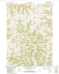
1983 Map of Sabin
USGS Topo · Published 1983About this map
The branching ridges and valleys of Richland County define the landscape surrounding Sabin and Bosstown in the early 1980s. This survey illustrates a rural interior dominated by dairy-farming terrain, where numerous cemeteries like Mill Creek Cem and Mt Tabor Cem provide a genealogical record of the townships of Sylvan, Bloom, and Marshall. The map documents a transition from an era of local country education at the Washington Sch and Sylvan Sch to a more contemporary landscape that includes a Radio Tower and private airstrips like the S & S Ranch Landing Strip. The dense network of hollows, including English Hollow and Searles Hollow, follows the drainage patterns toward the West Branch Mill Creek and Marshall Creek, revealing the intricate topography that dictated early settlement roads and field patterns in this portion of the Driftless Area.
Find a feature on this map
73 named features on this map. Tap any name to fly to it.
Don’t see what you’re looking for? This feature index may not catch every label — zoom into the map to look around manually.
Map Details
Editions of this 1983 Sabin Map
This is the sole edition of this map. No revisions or reprints were ever made.
Other maps of this area

1905 · Richland Center
USGS Topo · 1:125,000

1926 · La Farge
USGS Topo · 1:62,500

1927 · Hillsboro
USGS Topo · 1:62,500

1933 · Boaz
USGS Topo · 1:62,500

1958 · La Crosse
USGS Topo · 1:250,000

1960 · Richland Center
USGS Topo · 1:62,500

1961 · La Crosse
USGS Topo · 1:250,000

1965 · La Crosse
USGS Topo · 1:250,000

1965 · La Farge
USGS Topo · 1:62,500

1966 · Hillsboro
USGS Topo · 1:62,500