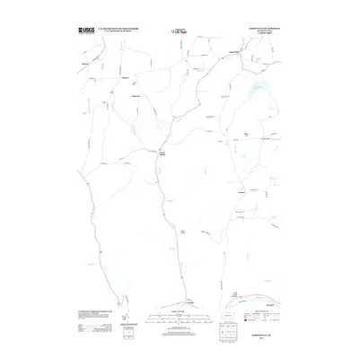
2013 Map of Sabinsville
USGS Topo · Published 2013About this map
Sabinsville serves as a primary hub for this portion of Tioga County, where the north-flowing Mill Cr meets several rural road networks. The landscape is defined by its dendritic drainage patterns, with Long Run and Blue Run carving deep into the terrain before feeding south toward the village of Gaines and the broader valley of Pine Cr. These waterways historically dictated the placement of small agricultural and railway settlements such as Davis Station, where the valley floor provided enough level ground for development.
Find a feature on this map
67 named features on this map. Tap any name to fly to it.
Don’t see what you’re looking for? This feature index may not catch every label — zoom into the map to look around manually.
Map Details
Editions of this 2013 Sabinsville Map
This is the sole edition of this map. No revisions or reprints were ever made.
Other maps of this area

1899 · Gaines
USGS Topo · 1:62,500

1900 · Gaines
USGS Topo · 1:62,500

1900 · Elkland
USGS Topo · 1:62,500

1946 · Tiadaghton
USGS Topo · 1:24,000

1946 · Antrim
USGS Topo · 1:62,500

1947 · Galeton
USGS Topo · 1:62,500

1947 · Galeton
USGS Topo · 1:24,000

1947 · Marshlands
USGS Topo · 1:24,000
1948 · Tiadaghton
USGS Topo · 1:24,000
1949 · Galeton
USGS Topo · 1:24,000
Featured Places
- Clymer Township, PA
- Gaines Township, PA
- Hector Township, PA
- Davis Station, Clymer Township
- Gurnee, Gaines Township