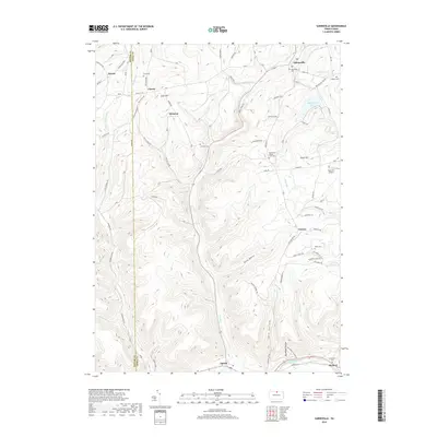
2019 Map of Sabinsville
USGS Topo · Published 2019About this map
Sabinsville and the surrounding township of Clymer are defined by the deep valleys and high ridges typical of this northern Tier landscape. The settlement patterns follow the winding paths of Potter Brook and Long Run, where small clusters of homes and family farms are anchored by local landmarks like Mixtown and Gurnee. High above the valleys, the terrain is marked by Scott Hill and Summit Ridge, with numerous small burial grounds such as Lovel Cem and Sabinsville Cem offering significant value for genealogical research in this rural region.
Find a feature on this map
97 named features on this map. Tap any name to fly to it.
Don’t see what you’re looking for? This feature index may not catch every label — zoom into the map to look around manually.
Map Details
Editions of this 2019 Sabinsville Map
This is the sole edition of this map. No revisions or reprints were ever made.
Other maps of this area

1899 · Gaines
USGS Topo · 1:62,500

1900 · Gaines
USGS Topo · 1:62,500

1900 · Elkland
USGS Topo · 1:62,500

1946 · Tiadaghton
USGS Topo · 1:24,000

1946 · Antrim
USGS Topo · 1:62,500

1947 · Galeton
USGS Topo · 1:62,500

1947 · Galeton
USGS Topo · 1:24,000

1947 · Marshlands
USGS Topo · 1:24,000
1948 · Tiadaghton
USGS Topo · 1:24,000
1949 · Galeton
USGS Topo · 1:24,000
Featured Places
- Clymer Township, PA
- Gaines Township, PA
- Hector Township, PA
- Davis Station, Clymer Township
- Gurnee, Gaines Township