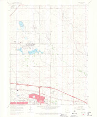
1965 Map of Sable
USGS Topo · Published 1966About this map
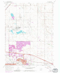
The Rocky Mountain Arsenal dominates the northern landscape of this 1965 survey, a massive military installation defined by its network of water features including Ladora Lake, Lake Mary, and Upper Derby Lake. This era shows the urban expansion of Aurora and Denver pushing eastward, with the industrial and transportation corridor along Sand Creek serving as a primary focal point. The map captures the significant infrastructure of the Stapleton International Airport and the sprawling US Army Fitzsimons General Hospital complex just as suburban growth began to surround them.
Find a feature on this map
63 named features on this map. Tap any name to fly to it.
Don’t see what you’re looking for? This feature index may not catch every label — zoom into the map to look around manually.
Map Details
Editions of this 1965 Sable Map
7 editions found
Other maps of this area

1890 · East Denver
USGS Topo · 1:125,000

1935 · East Denver Nos. 3 and 4
USGS Topo · 1:48,000

1938 · Derby
USGS Topo · 1:24,000

1938 · Long Branch
USGS Topo · 1:24,000

1939 · Coal Creek
USGS Topo · 1:24,000

1940 · Brighton
USGS Topo · 1:31,680

1940 · Englewood
USGS Topo · 1:31,680

1940 · Eastlake
USGS Topo · 1:31,680

1940 · Derby
USGS Topo · 1:31,680

1941 · Long Branch
USGS Topo · 1:31,680