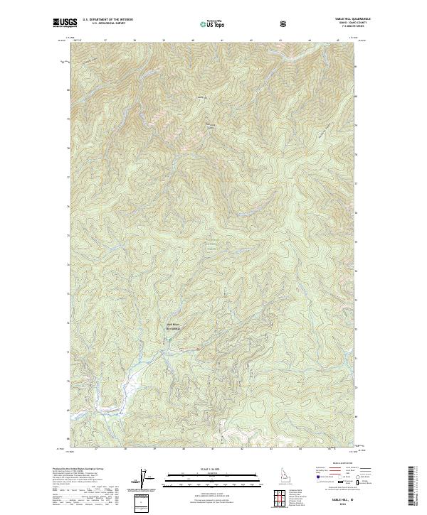
2024 Map of Sable Hill
USGS Topo · Published 2024About this map
Red River Hot Springs serves as a focal point for this landscape within the Nez Perce National Forest, where the topography is defined by high ridges and a dense network of watercourses. The local road system is sparse, primarily represented by Hot Springs Rd following the course of the Red River, suggesting a reliance on these natural corridors for access. The drainage patterns are intricate, with Sable Creek and its East and West forks carving into the terrain near Sable Hill, while Matteson Ridge and Simmons Ridge form significant natural boundaries.
Find a feature on this map
33 named features on this map. Tap any name to fly to it.
Don’t see what you’re looking for? This feature index may not catch every label — zoom into the map to look around manually.
Map Details
Editions of this 2024 Sable Hill Map
This is the sole edition of this map. No revisions or reprints were ever made.
Other maps of this area

1956 · Elk City
USGS Topo · 1:250,000

1960 · Elk City
USGS Topo · 1:250,000

1966 · Green Mtn.
USGS Topo · 1:24,000

1966 · Black Hawk Mtn
USGS Topo · 1:24,000

1966 · Sable Hill
USGS Topo · 1:24,000

1966 · Anderson Butte
USGS Topo · 1:24,000
1966 · Running Lake
USGS Topo · 1:24,000
1966 · Vermilion Peak
USGS Topo · 1:24,000

1977 · Boston Mtn
USGS Topo · 1:24,000

1978 · Spread Creek Point
USGS Topo · 1:24,000