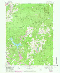
1959 Map of Sabula
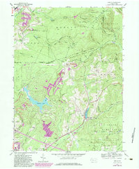
USGS Topo · Published 1972About this map
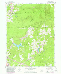
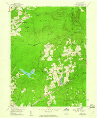
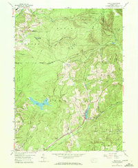
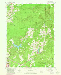
Sandy Lick Creek and its many tributaries, including Muddy Creek and Lick Run, carve through this heavily forested section of the Allegheny Plateau during the early 1970s. The village of Sabula serves as a focal point near the shore of Lake Sabula, where the Penn Central Railroad and several highways converge. This landscape is a complex mix of conservation and industry, featuring the extensive Moshannon State Forest alongside numerous strip mines that mark the hillsides. Genealogists will find several burial sites noted across the townships, from the Bundy Cem in the north to Morningside Cemetery near Du Bois in the south. The presence of infrastructure like the Brockway Reservoir and various gas wells indicates the region's role in local utility and resource extraction, while Lake Rene and a Boy Scout Camp highlight the area's recreational use.
Find a feature on this map
56 named features on this map. Tap any name to fly to it.
Don’t see what you’re looking for? This feature index may not catch every label — zoom into the map to look around manually.
Map Details
Editions of this 1959 Sabula Map
7 editions found
Historical Maps of Sandy Township Through Time
30 maps found

1929 Karthaus
Clearfield County, PA

1929 Penfield
Clearfield County, PA

1932 Karthaus
Clearfield County, PA

1932 Penfield
Clearfield County, PA

1944 Glen Richey
Clearfield County, PA

1946 Glen Richey
Clearfield County, PA

1959 Devils Elbow
Clearfield County, PA

1959 Elliott Park
Clearfield County, PA

1959 Frenchville
Clearfield County, PA

1959 Huntley
Clearfield County, PA

1959 Lecontes Mills
Clearfield County, PA

1959 Luthersburg
Clearfield County, PA

1959 Penfield
Clearfield County, PA

1959 Sabula
Clearfield County, PA

1959 The Knobs
Clearfield County, PA

1968 Mc Gees Mills
Clearfield County, PA

1993 Glen Richey
Clearfield County, PA

1993 Penfield
Clearfield County, PA

2000 Lecontes Mills
Clearfield County, PA

2023 Devils Elbow
Clearfield County, PA

2023 Elliott Park
Clearfield County, PA

2023 Frenchville
Clearfield County, PA

2023 Glen Richey
Clearfield County, PA

2023 Huntley
Clearfield County, PA

2023 Lecontes Mills
Clearfield County, PA

2023 Luthersburg
Clearfield County, PA

2023 McGees Mills
Clearfield County, PA

2023 Penfield
Clearfield County, PA

2023 Sabula
Clearfield County, PA

2023 The Knobs
Clearfield County, PA