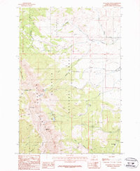
1987 Map of Sacagawea Peak
USGS Topo · Published 1987About this map
Sacagawea Peak and Hardscrabble Peak anchor the high elevations of the Bridger Range in this 1980s survey of the Gallatin National Forest. The landscape is defined by its drainage systems, where the South Fork Sixteenmile Creek and various branches of Flathead Creek carve through the mountain terrain. For researchers, the map provides a clear view of the recreational and natural layout of the era, including the Fairy Lake Campground situated near Fairy Lake and Elf Lake. The southern boundary reveals deep geological cuts such as Corbly Canyon and Limestone Canyon. High-altitude water bodies like Ainger Lake and Frazier Lake sit tucked below the peaks, while the Battle Ridge Campground serves as a notable landmark on the eastern edge of the quadrangle.
Find a feature on this map
29 named features on this map. Tap any name to fly to it.
Don’t see what you’re looking for? This feature index may not catch every label — zoom into the map to look around manually.
Map Details
Editions of this 1987 Sacagawea Peak Map
2 editions found
Other maps of this area

1886 · Fort Logan
USGS Topo · 1:250,000

1886 · Little Belt Mts.
USGS Topo · 1:250,000

1888 · Three Forks
USGS Topo · 1:250,000

1891 · Livingston
USGS Topo · 1:250,000

1893 · Livingston
USGS Topo · 1:250,000

1894 · Three Forks
USGS Topo · 1:250,000

1894 · Little Belt Mts.
USGS Topo · 1:250,000

1895 · Three Forks
USGS Topo · 1:250,000

1897 · Little Belt Mts.
USGS Topo · 1:250,000

1898 · Little Belt Mts.
USGS Topo · 1:250,000