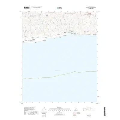
2018 Map of Sacate
USGS Topo · Published 2018About this map
The Santa Ynez Mountains dominate the northern landscape of this coastal quadrangle, where steep ridges descend toward the Pacific Ocean. This stretch of the Santa Barbara coastline is defined by a series of narrow canyons, or cañadas, that cut through the terrain to the sea, including Cañada Del Coyote and Cañada de Santa Anita. Small settlements like San Augustine and Sacate are situated along the narrow coastal shelf, where the Southern Pacific railroad historically facilitated movement through this isolated region. The presence of Hollister Ranch Rd and Rancho Real underscores the area's long-standing ranching tradition. Waterways such as Arroyo San Agustin and Arroyo El Bulito drain the southern slopes of the mountains, tracing the natural contours that have dictated the placement of roads and homesteads for generations.
Find a feature on this map
25 named features on this map. Tap any name to fly to it.
Don’t see what you’re looking for? This feature index may not catch every label — zoom into the map to look around manually.
Map Details
Editions of this 2018 Sacate Map
This is the sole edition of this map. No revisions or reprints were ever made.
Other maps of this area

1905 · Lompoc
USGS Topo · 1:125,000

1942 · Lompoc
USGS Topo · 1:125,000

1942 · Lompoc
USGS Topo · 1:62,500

1942 · Pt. Conception
USGS Topo · 1:62,500

1942 · Gaviota
USGS Topo · 1:62,500

1942 · Los Olivos
USGS Topo · 1:62,500

1943 · Los Olivos
USGS Topo · 1:62,500

1943 · Lompoc
USGS Topo · 1:125,000

1943 · Gaviota
USGS Topo · 1:62,500

1947 · Gaviota
USGS Topo · 1:62,500