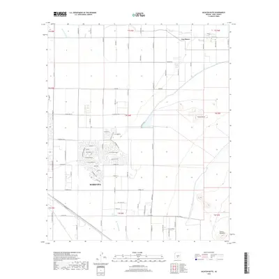
2018 Map of Sacaton Butte
USGS Topo · Published 2018About this map
The growing desert community of Maricopa centers this 2018 survey, showcasing a grid of modern residential streets such as Velazquez Dr and Picasso St expanding into the arid landscape. The terrain is defined by the ephemeral courses of Santa Cruz Wash and Santa Rosa Wash, which traverse the flat valley floor toward the Sacaton Mountains in the southeast. Historical land use is evident in the network of tribal roads to the north, including Indian Rte 87 and Indian Rte 85, which connect the settlement of Casa Blanca to the surrounding region. The prominent landmark of Sacaton Butte stands as a distinct topographical feature in the eastern portion of the quadrangle. This map documents the transition of the area from open desert and tribal lands into a suburban hub, while maintaining the underlying drainage patterns that have shaped the Gila River Valley.
Find a feature on this map
77 named features on this map. Tap any name to fly to it.
Don’t see what you’re looking for? This feature index may not catch every label — zoom into the map to look around manually.
Map Details
Editions of this 2018 Sacaton Butte Map
This is the sole edition of this map. No revisions or reprints were ever made.
Other maps of this area

1913 · Maricopa
USGS Topo · 1:62,500

1914 · Gila Butte
USGS Topo · 1:62,500

1915 · Maricopa
USGS Topo · 1:62,500

1917 · Gila Butte
USGS Topo · 1:62,500

1922 · Casa Grande
USGS Topo · 1:62,500

1924 · Casa Grande
USGS Topo · 1:62,500

1946 · Antelope Peak
USGS Topo · 1:62,500

1948 · Antelope Peak
USGS Topo · 1:62,500

1952 · Gila Butte SE
USGS Topo · 1:24,000

1952 · Maricopa
USGS Topo · 1:24,000