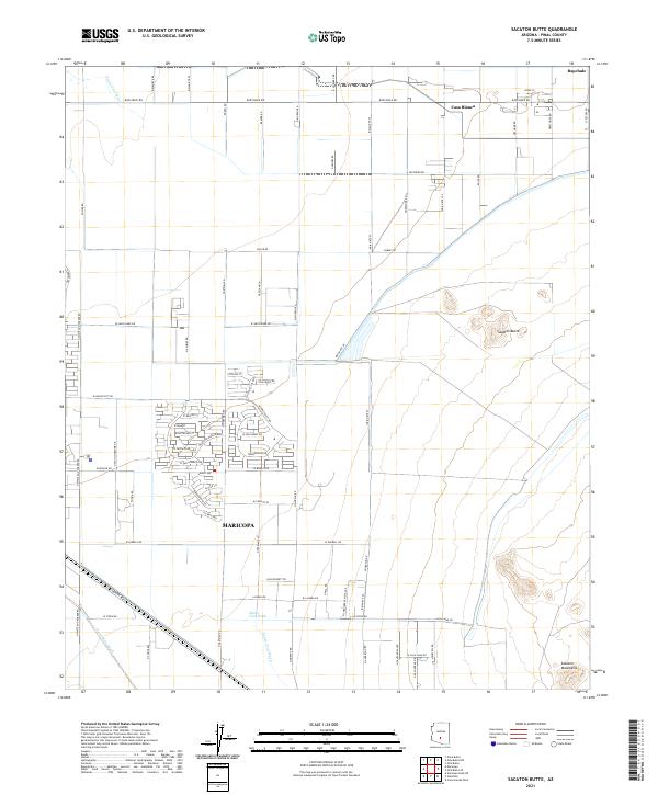
2021 Map of Sacaton Butte
USGS Topo · Published 2021About this map
Maricopa anchors the southwestern portion of this Pinal County landscape, showing a period of significant residential expansion defined by modern subdivisions like those along Smith Enke Rd and Costa Del Sol Blvd. The terrain is shaped by the ephemeral drainage of the Santa Cruz Wash and Santa Rosa Wash, which traverse a desert floor punctuated by the prominent Sacaton Butte. To the north and east, the character shifts toward more traditional indigenous community layouts, with the settlements of Casa Blanca and Bapchule linked by an extensive network of tribal routes including Indian Rte 87 and Indian Rte 97. The contrast between the grid-based development of the city and the traditional land use in the adjacent Gila River Indian Community territory is clearly visible, providing a clear record of recent growth patterns against the backdrop of the southern Sacaton Mountains.
Find a feature on this map
80 named features on this map. Tap any name to fly to it.
Don’t see what you’re looking for? This feature index may not catch every label — zoom into the map to look around manually.
Map Details
Editions of this 2021 Sacaton Butte Map
This is the sole edition of this map. No revisions or reprints were ever made.
Other maps of this area

1913 · Maricopa
USGS Topo · 1:62,500

1914 · Gila Butte
USGS Topo · 1:62,500

1915 · Maricopa
USGS Topo · 1:62,500

1917 · Gila Butte
USGS Topo · 1:62,500

1922 · Casa Grande
USGS Topo · 1:62,500

1924 · Casa Grande
USGS Topo · 1:62,500

1946 · Antelope Peak
USGS Topo · 1:62,500

1948 · Antelope Peak
USGS Topo · 1:62,500

1952 · Gila Butte SE
USGS Topo · 1:24,000

1952 · Maricopa
USGS Topo · 1:24,000