
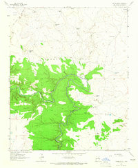
1963 Map of Sacaton Draw
USGS Topo · Published 1965About this map
Preston Beck Grant lands define this portion of the New Mexico landscape in the early 1960s, where livestock ranching and transportation infrastructure intersect. The drainage of Sacaton Draw and Gonzales Creek provide the primary geographic framework for a network of isolated ranches and watering points like Ratcliff Ranch, Gonzales Camp, and Double Mills. Water management is critical in this arid terrain, evidenced by numerous named catchments such as Salitre Tank, Upper Tank, and North Los Tanos Tank scattered across the range.
Find a feature on this map
25 named features on this map. Tap any name to fly to it.
Don’t see what you’re looking for? This feature index may not catch every label — zoom into the map to look around manually.
Map Details
Editions of this 1963 Sacaton Draw Map
This is the sole edition of this map. No revisions or reprints were ever made.
Other maps of this area

1892 · Corazon
USGS Topo · 1:125,000

1894 · Corazon
USGS Topo · 1:125,000

1954 · Santa Fe
USGS Topo · 1:250,000

1954 · Fort Sumner
USGS Topo · 1:250,000

1958 · Fort Sumner
USGS Topo · 1:250,000

1958 · Santa Fe
USGS Topo · 1:250,000

1963 · Santa Rosa
USGS Topo · 1:24,000

1963 · Sunshine Mesa
USGS Topo · 1:24,000

1963 · Mesa Cherisco
USGS Topo · 1:24,000
1963 · Catfish Falls
USGS Topo · 1:24,000