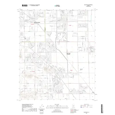
2018 Map of Sacaton NE
USGS Topo · Published 2018About this map
San Tan Valley and Queen Creek characterize this rapidly developing landscape at the border of Maricopa and Pinal Counties. The map reveals a dense network of residential streets and subdivisions extending south of the ephemeral Queen Creek, juxtaposed with major infrastructure like the Central Arizona Project Aqueduct in the east. Educational growth is marked by the presence of Central Arizona College - San Tan Campus, while the local aviation sector is represented by Pegasus Airpark. The settlement of Magma sits at the southeastern corner, serving as a nodal point near the intersection of various local routes like E Olberg Rd. The desert terrain is heavily defined by the modern transition from agricultural or open land to a structured suburban grid, all while maintaining the vital water transport corridors essential to this arid region.
Find a feature on this map
22 named features on this map. Tap any name to fly to it.
Don’t see what you’re looking for? This feature index may not catch every label — zoom into the map to look around manually.
Map Details
Editions of this 2018 Sacaton NE Map
This is the sole edition of this map. No revisions or reprints were ever made.
Other maps of this area

1900 · Florence
USGS Topo · 1:125,000

1902 · Florence
USGS Topo · 1:125,000

1904 · Desert Well
USGS Topo · 1:62,500

1906 · Desert Well
USGS Topo · 1:62,500

1907 · Sacaton
USGS Topo · 1:62,500

1954 · Mesa
USGS Topo · 1:250,000

1956 · Sacaton NE
USGS Topo · 1:24,000

1956 · Magma
USGS Topo · 1:24,000
1956 · Chandler Heights
USGS Topo · 1:24,000

1956 · Desert Well
USGS Topo · 1:24,000