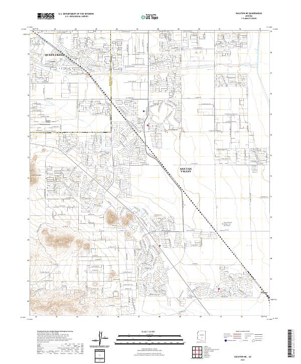
2021 Map of Sacaton NE
USGS Topo · Published 2021About this map
Queen Creek and San Tan Valley dominate this modern landscape, where residential development and suburban infrastructure are seen expanding across the desert floor. The map highlights a significant transition in land use, showing the modern street grid of the Maricopa and Pinal Co border area. Major civil engineering projects define the eastern edge of the quadrangle, notably the Central Arizona Project Aqueduct, which brings water through this arid region. Educational and recreational facilities like the Central Arizona College - San Tan Campus and Pegasus Airpark reflect the growth of the community in the early 21st century. Natural landmarks remain prominent despite the urban spread, with the elevation of Goldmine Mtn rising to the west and the seasonal drainage of Queen Creek winding through the developed areas toward Magma in the southeast.
Find a feature on this map
30 named features on this map. Tap any name to fly to it.
Don’t see what you’re looking for? This feature index may not catch every label — zoom into the map to look around manually.
Map Details
Editions of this 2021 Sacaton NE Map
This is the sole edition of this map. No revisions or reprints were ever made.
Other maps of this area

1900 · Florence
USGS Topo · 1:125,000

1902 · Florence
USGS Topo · 1:125,000

1904 · Desert Well
USGS Topo · 1:62,500

1906 · Desert Well
USGS Topo · 1:62,500

1907 · Sacaton
USGS Topo · 1:62,500

1954 · Mesa
USGS Topo · 1:250,000

1956 · Sacaton NE
USGS Topo · 1:24,000

1956 · Magma
USGS Topo · 1:24,000
1956 · Chandler Heights
USGS Topo · 1:24,000

1956 · Desert Well
USGS Topo · 1:24,000