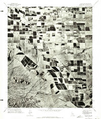
1971 Map of Sacaton NE
USGS Topo · Published 1972About this map
The agricultural grid of Pinal and Maricopa counties dominates this 1971 orthophotomosaic, revealing a landscape defined by intensive irrigation and desert topography. The stark contrast between the cultivated dark and light geometric fields and the natural drainage patterns is most evident along the banks of Queen Creek as it cuts across the northern half of the map. To the southwest, the arid slopes of Goldmine Mountain rise abruptly from the valley floor, providing a sharp topographical boundary to the sprawling farmland. This aerial-based survey documents the specific footprint of Arizona’s desert agriculture and rural development during the early 1970s, showing the exact layout of individual farms, access roads, and water management systems that transformed this section of the Gila River Valley.
Find a feature on this map
2 named features on this map. Tap any name to fly to it.
Don’t see what you’re looking for? This feature index may not catch every label — zoom into the map to look around manually.
Map Details
Editions of this 1971 Sacaton NE Map
This is the sole edition of this map. No revisions or reprints were ever made.
Other maps of this area

1900 · Florence
USGS Topo · 1:125,000

1902 · Florence
USGS Topo · 1:125,000

1904 · Desert Well
USGS Topo · 1:62,500

1906 · Desert Well
USGS Topo · 1:62,500

1907 · Sacaton
USGS Topo · 1:62,500

1954 · Mesa
USGS Topo · 1:250,000

1956 · Sacaton NE
USGS Topo · 1:24,000

1956 · Magma
USGS Topo · 1:24,000
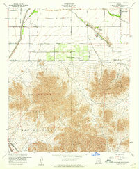
1956 · Chandler Heights
USGS Topo · 1:24,000

1956 · Desert Well
USGS Topo · 1:24,000