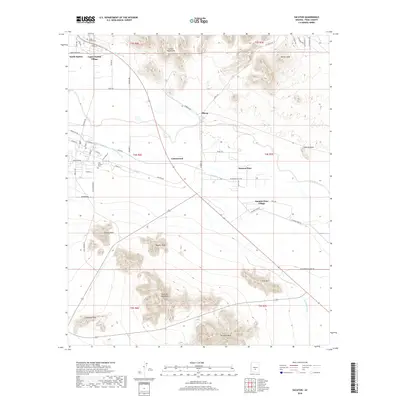
2018 Map of Sacaton
USGS Topo · Published 2018About this map
Upper Santan Village and South Santan anchor the northern landscape of this Pinal County region, where the Gila River corridor dictates the patterns of settlement and agriculture. The reliance on water management is evident through a complex network of irrigation features, including the Santan Canal, Casa Blanca Canal, Little Gila Canal, and the Southside Canal. These man-made waterways cut across the desert floor to support communities like Cottonwood, Olberg, and Sacaton Flats, illustrating the vital connection between river access and habitability in this arid environment.
Find a feature on this map
62 named features on this map. Tap any name to fly to it.
Don’t see what you’re looking for? This feature index may not catch every label — zoom into the map to look around manually.
Map Details
Editions of this 2018 Sacaton Map
This is the sole edition of this map. No revisions or reprints were ever made.
Other maps of this area

1907 · Sacaton
USGS Topo · 1:62,500

1914 · Gila Butte
USGS Topo · 1:62,500

1917 · Gila Butte
USGS Topo · 1:62,500

1922 · Casa Grande
USGS Topo · 1:62,500

1922 · Signal Peak
USGS Topo · 1:62,500

1924 · Signal Peak
USGS Topo · 1:62,500

1924 · Casa Grande
USGS Topo · 1:62,500

1952 · Gila Butte SE
USGS Topo · 1:24,000

1952 · Gila Butte
USGS Topo · 1:24,000

1952 · Gila Butte
USGS Topo · 1:62,500