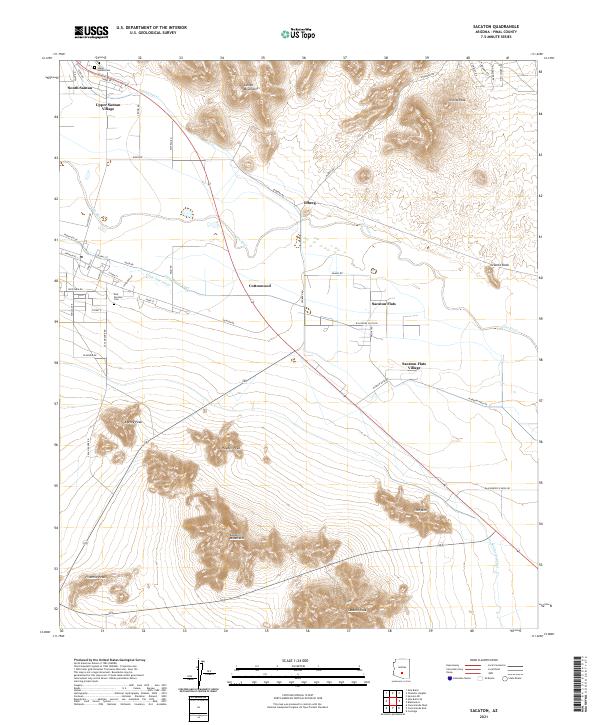
2021 Map of Sacaton
USGS Topo · Published 2021About this map
The Gila River valley dominates this landscape, where a sophisticated network of desert irrigation channels like the Santan Canal, Little Gila Canal, and Casa Blanca Canal support local agriculture. The terrain is dramatically defined by the Santan Mountains to the north and the Sacaton Mountains to the south, with prominent peaks such as Sacaton Peak and Hayden Peak rising from the basin floor. This area is characterized by distinct tribal communities including Upper Santan Village, Sacaton Flats Village, and the settlement at Olberg. Researchers can find significant genealogical landmarks like the Upper Santan Cem and East Sacaton Cem, alongside historical transport routes such as Indian Rte 85 and Sacaton Rd that connect these agrarian centers.
Find a feature on this map
61 named features on this map. Tap any name to fly to it.
Don’t see what you’re looking for? This feature index may not catch every label — zoom into the map to look around manually.
Map Details
Editions of this 2021 Sacaton Map
This is the sole edition of this map. No revisions or reprints were ever made.
Other maps of this area

1907 · Sacaton
USGS Topo · 1:62,500

1914 · Gila Butte
USGS Topo · 1:62,500

1917 · Gila Butte
USGS Topo · 1:62,500

1922 · Casa Grande
USGS Topo · 1:62,500

1922 · Signal Peak
USGS Topo · 1:62,500

1924 · Signal Peak
USGS Topo · 1:62,500

1924 · Casa Grande
USGS Topo · 1:62,500

1952 · Gila Butte SE
USGS Topo · 1:24,000

1952 · Gila Butte
USGS Topo · 1:24,000

1952 · Gila Butte
USGS Topo · 1:62,500