Loading...
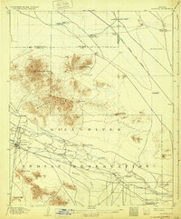
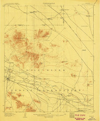
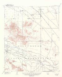
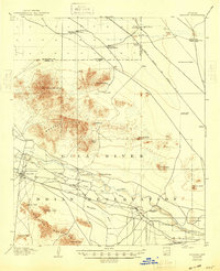
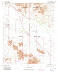
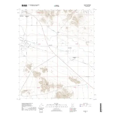
Loading map...1907 Map of Sacaton
USGS Topo · Published 1932About this map
Gila River Indian Reservation dominates this early twentieth-century landscape, centered on the settlement of Sacaton. The map reveals a high-desert environment dependent on carefully managed water sources, from the Government Pumping Plant to numerous deep wells like Indian Well and the Old Government Tanks. The infrastructure of the era is clearly defined by the Santa Fe Prescott and Phoenix R. R. cutting across the northeastern corner.
Find a feature on this map
44 named features on this map. Tap any name to fly to it.
Don’t see what you’re looking for? This feature index may not catch every label — zoom into the map to look around manually.
Map Details
Date Portrayed1907
Date Published1932
PublisherU.S. Geological Survey
Map TypeTopographic
Scale1:62,500
Physical Dimensions16.3 x 19.7 inches
Editions of this 1907 Sacaton Map
4 editions found
Historical Maps of Gilbert Through Time
7 maps found
Featured Locations
Source Details
SourceU.S. Geological Survey
CopyrightPublic Domain