1905 Map of Saco Special
USGS Topo · Published 1905About this map
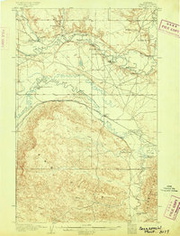
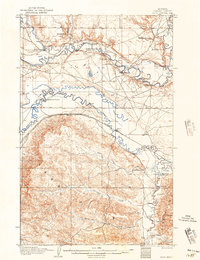
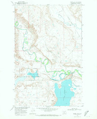
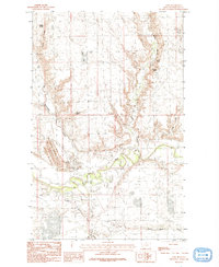
Larb Hills rise sharply south of the meandering Milk River in this 1903 survey, revealing a landscape defined by ranching and the arrival of the railroad. The terrain is deeply dissected by drainage systems like First Creek, Second Creek, and Third Creek, which flow toward the Beaver Creek valley. While Saco and Beaverton serve as the primary hubs along the Great Northern R. R., the rural social fabric is composed of numerous family-named landmarks including Taylor's Ranch, Abel's Ranch, and Whitfords Ranch.
Find a feature on this map
35 named features on this map. Tap any name to fly to it.
Don’t see what you’re looking for? This feature index may not catch every label — zoom into the map to look around manually.
Map Details
Editions of this 1905 Saco Special Map
2 editions found
Other maps of this area
1905 · Bowdoin
USGS Topo · 1:62,500
1906 · Hinsdale Special Map
USGS Topo · 1:62,500

1920 · Cowan
USGS Topo · 1:125,000

1954 · Glasgow
USGS Topo · 1:250,000

1957 · Glasgow
USGS Topo · 1:250,000

1958 · Glasgow
USGS Topo · 1:250,000
1968 · Hewitt Lake
USGS Topo · 1:24,000
1984 · Cole
USGS Topo · 1:24,000
1984 · Pinks
USGS Topo · 1:24,000
1984 · Bjornberg Bridge
USGS Topo · 1:24,000