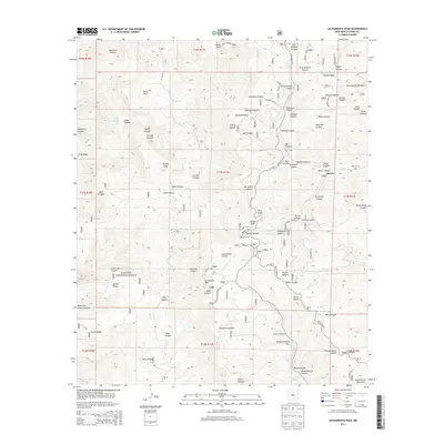
2013 Map of Sacramento Peak
USGS Topo · Published 2013About this map
The high ridges of the Sacramento Mountains define this landscape, where the Sunspot Hwy winds through the Lincoln National Forest. Significant scientific and observational infrastructure is visible at these altitudes, including the Apache Point Observatory, the Wave Site, and the Alamo Lookout. The map provides a detailed view of the complex drainage systems that feed into the Sacramento River and the Rio Peñasco, cutting deep canyons such as Caballero Canyon and Peñasco Canyon into the mountain face.
Find a feature on this map
72 named features on this map. Tap any name to fly to it.
Don’t see what you’re looking for? This feature index may not catch every label — zoom into the map to look around manually.
Map Details
Editions of this 2013 Sacramento Peak Map
This is the sole edition of this map. No revisions or reprints were ever made.
Other maps of this area

1950 · Escondido Canyon
USGS Topo · 1:62,500

1950 · Alamogordo
USGS Topo · 1:62,500

1952 · Cloudcroft
USGS Topo · 1:62,500

1954 · Carlsbad
USGS Topo · 1:250,000

1958 · Carlsbad
USGS Topo · 1:250,000

1965 · Rogers Ruins
USGS Topo · 1:24,000
1974 · Bluff Springs
USGS Topo · 1:24,000

1976 · Mule Peak
USGS Topo · 1:24,000
1976 · Alamogordo
USGS Topo · 1:24,000
1977 · Cloudcroft
USGS Topo · 1:24,000