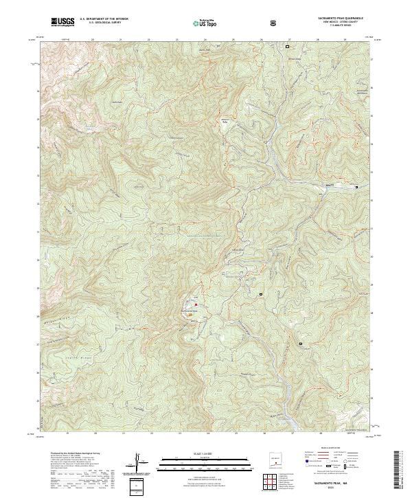
2023 Map of Sacramento Peak
USGS Topo · Published 2023About this map
High-altitude scientific research and traditional ranching intersect within the Lincoln National Forest on this survey of the Sacramento Mountains. The area is dominated by the Apache Point Observatory and other technical installations like the Wave Site and Frequency Monitor, marking this as a significant hub for astronomical study. The rugged topography is etched with numerous named canyons, including San Andres Canyon and Alamo Canyon, while the Sacramento River flows toward the southern boundary at Sacramento Lake. Traces of earlier mountain life remain at the settlement of Marcia and the Marcia Cem, while fire prevention infrastructure is represented by the Sacramento L O lookout. A dense network of trails such as the Rim Trl and Sunspot Trl navigate the high ridges, connecting these remote outposts.
Find a feature on this map
92 named features on this map. Tap any name to fly to it.
Don’t see what you’re looking for? This feature index may not catch every label — zoom into the map to look around manually.
Map Details
Editions of this 2023 Sacramento Peak Map
This is the sole edition of this map. No revisions or reprints were ever made.
Other maps of this area

1950 · Escondido Canyon
USGS Topo · 1:62,500

1950 · Alamogordo
USGS Topo · 1:62,500

1952 · Cloudcroft
USGS Topo · 1:62,500

1954 · Carlsbad
USGS Topo · 1:250,000

1958 · Carlsbad
USGS Topo · 1:250,000

1965 · Rogers Ruins
USGS Topo · 1:24,000
1974 · Bluff Springs
USGS Topo · 1:24,000

1976 · Mule Peak
USGS Topo · 1:24,000
1976 · Alamogordo
USGS Topo · 1:24,000
1977 · Cloudcroft
USGS Topo · 1:24,000