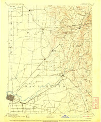
1892 Map of Sacramento
USGS Topo · Published 1908About this map
Sacramento sits at the nexus of California's Central Valley river systems and the late-nineteenth-century rail boom, shown here before the intensive suburbanization of the twentieth century. The American River flows from the foothills of El Dorado past the Penitentiary at Folsom, while the Central Pacific Railroad and Placerville & Sacramento Railroad corridors dictate the location of burgeoning trade centers. Small stage stops and waystations like 6 Mile House and 12 Mile House appear alongside established ranching and agricultural sites such as Whitney's Ranch. To the north, the terrain transitions into the gold-bearing foothills near Auburn and Ophir, where the landscape is marked by ravines and granite outcroppings like Boulder Ridge. This survey documents the critical period when transit infrastructure began to consolidate the scattered foothill settlements into the primary transit corridor between the state capital and the Sierra Nevada.
Find a feature on this map
103 named features on this map. Tap any name to fly to it.
Don’t see what you’re looking for? This feature index may not catch every label — zoom into the map to look around manually.
Map Details
Editions of this 1892 Sacramento Map
5 editions found
Other maps of this area

1888 · Marysville
USGS Topo · 1:125,000

1888 · Smartsville
USGS Topo · 1:125,000

1889 · Jackson
USGS Topo · 1:125,000

1891 · Sacramento
USGS Topo · 1:125,000

1891 · Colfax
USGS Topo · 1:125,000

1891 · Marysville
USGS Topo · 1:125,000

1891 · Smartsville
USGS Topo · 1:125,000

1891 · Placerville
USGS Topo · 1:125,000

1892 · Jackson
USGS Topo · 1:125,000

1892 · Sacramento
USGS Topo · 1:125,000