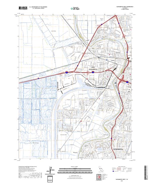
2023 Map of Sacramento West
USGS Topo · Published 2023About this map
The Sacramento River carves through the heart of this California valley landscape, separating the urban core of Sacramento from the industrial and residential corridors of West Sacramento. This map details the complex water infrastructure of the region, including the massive Sacramento River Deep Water Ship Channel and its Turning Basin, which connect to Lake Washington. The western portion of the quadrangle is dominated by the agricultural and conservation lands of the Central Valley, featuring the North Central Valley Wildlife Management Area and the Putah Creek Sinks. Genealogists and local historians can locate several major burial grounds on the eastern bank, such as the Sacramento City Cem and Masonic Lawn Cem. Transportation networks are prominent, from the Sacramento Executive Airport in the south to the multiple university campuses and the CHP Academy serving the regional population.
Find a feature on this map
56 named features on this map. Tap any name to fly to it.
Don’t see what you’re looking for? This feature index may not catch every label — zoom into the map to look around manually.
Map Details
Editions of this 2023 Sacramento West Map
This is the sole edition of this map. No revisions or reprints were ever made.
Other maps of this area

1891 · Sacramento
USGS Topo · 1:125,000

1892 · Sacramento
USGS Topo · 1:125,000

1893 · Sacramento
USGS Topo · 1:125,000

1894 · Lodi
USGS Topo · 1:125,000

1902 · Fairoaks
USGS Topo · 1:62,500

1907 · Davisville
USGS Topo · 1:62,500

1908 · Courtland
USGS Topo · 1:62,500

1909 · Florin
USGS Topo · 1:31,680

1911 · Brighton
USGS Topo · 1:31,680

1911 · Arcade
USGS Topo · 1:31,680
Featured Places
- Sacramento, CA
- West Sacramento, CA
- Mikon, West Sacramento
- Lovdal, West Sacramento
- Broderick, West Sacramento