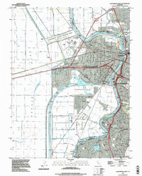
1992 Map of Sacramento West
USGS Topo · Published 1997About this map
The Sacramento River forms a critical dividing line in this 1990s-era study, separating the capital city of Sacramento from the industrial and transport-oriented landscape of West Sacramento. To the west, the engineering of the Deep Water Ship Channel and the Turning Basin at the Port of Sacramento illustrates the area's mid-century transformation into a major inland shipping hub. This maritime infrastructure sits alongside the older foundations of riverfront life in Bryte and Broderick, while the northern reach shows the Sacramento Bypass functioning as essential flood control for the American Basin. On the eastern bank, the urban fabric includes landmarks like Old Sacramento State Historical Park and the extensive grounds of William Land Park, providing a view of the city as it modernised while preserving its historic riverfront roots.
Find a feature on this map
46 named features on this map. Tap any name to fly to it.
Don’t see what you’re looking for? This feature index may not catch every label — zoom into the map to look around manually.
Map Details
Editions of this 1992 Sacramento West Map
This is the sole edition of this map. No revisions or reprints were ever made.
Other maps of this area

1891 · Sacramento
USGS Topo · 1:125,000

1892 · Sacramento
USGS Topo · 1:125,000

1893 · Sacramento
USGS Topo · 1:125,000

1894 · Lodi
USGS Topo · 1:125,000

1902 · Fairoaks
USGS Topo · 1:62,500

1907 · Davisville
USGS Topo · 1:62,500

1908 · Courtland
USGS Topo · 1:62,500

1909 · Florin
USGS Topo · 1:31,680

1911 · Brighton
USGS Topo · 1:31,680

1911 · Arcade
USGS Topo · 1:31,680
Featured Places
- Sacramento, CA
- West Sacramento, CA
- Mikon, West Sacramento
- Riverview, West Sacramento
- Lovdal, West Sacramento