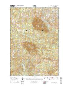
2014 Map of Saddle Mountain
USGS Topo · Published 2014About this map
Saddle Mountain and Humbug Mtn dominate the high ground of the Oregon Coast Range in this 2014 survey. This area serves as a significant drainage divide for Clatsop County, where the headwaters of the Youngs River flow north, while the Necanicum River and Little Fork Nehalem River drain to the south and west. The landscape is defined by its complex hydrology, featuring numerous named tributaries such as Destruction Cr, Beaver Cr, and Little Fishhawk Cr. Transportation through this timber-rich region is largely restricted to Us-26, which winds through the southern portion of the quadrangle, and the Fishhawk Mainline road network. Significant ridges like Flagpole Ridge provide structural definition to the watershed, illustrating the steep topography that separates the Lewis and Clark River system from the surrounding coastal basins.
Find a feature on this map
28 named features on this map. Tap any name to fly to it.
Don’t see what you’re looking for? This feature index may not catch every label — zoom into the map to look around manually.
Map Details
Editions of this 2014 Saddle Mountain Map
This is the sole edition of this map. No revisions or reprints were ever made.
Other maps of this area

1919 · Astoria
USGS Topo · 1:62,500

1939 · Astoria
USGS Topo · 1:62,500

1939 · Saddle Mountain
USGS Topo · 1:62,500

1940 · Svensen
USGS Topo · 1:62,500

1940 · Cape Falcon
USGS Topo · 1:62,500

1943 · Saddle Mtn.
USGS Topo · 1:62,500

1948 · Vancouver
USGS Topo · 1:250,000

1949 · Green Mountain
USGS Topo · 1:24,000
1949 · Olney
USGS Topo · 1:24,000

1950 · Vancouver
USGS Topo · 1:250,000