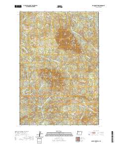
2020 Map of Saddle Mountain
USGS Topo · Published 2020About this map
Saddle Mtn dominates this portion of the Northern Oregon Coast Range, serving as a prominent landmark for the drainage systems that define the regional hydrology. The peak anchors a complex network of waterways, including the headwaters of the Lewis and Clark River and the Necanicum River, which flow through deep-cut valleys. The presence of Saddle Mtn St Park Rd and the CCC Rd indicates a long-standing history of public access and conservation efforts in these uplands. To the south and east, the terrain transitions into the basins of the Little N Fork Nehalem River and Beaver Cr, while Humbug Mtn and Flagpole Ridge stand as significant topographical barriers. This 2020 map documents a landscape defined by its river-and-ridge geography, where named features like Destruction Cr and Osgood Cr trace the intricate path of water from high peaks toward the coast.
Find a feature on this map
28 named features on this map. Tap any name to fly to it.
Don’t see what you’re looking for? This feature index may not catch every label — zoom into the map to look around manually.
Map Details
Editions of this 2020 Saddle Mountain Map
This is the sole edition of this map. No revisions or reprints were ever made.
Other maps of this area

1919 · Astoria
USGS Topo · 1:62,500

1939 · Astoria
USGS Topo · 1:62,500

1939 · Saddle Mountain
USGS Topo · 1:62,500

1940 · Svensen
USGS Topo · 1:62,500

1940 · Cape Falcon
USGS Topo · 1:62,500

1943 · Saddle Mtn.
USGS Topo · 1:62,500

1948 · Vancouver
USGS Topo · 1:250,000

1949 · Green Mountain
USGS Topo · 1:24,000
1949 · Olney
USGS Topo · 1:24,000

1950 · Vancouver
USGS Topo · 1:250,000