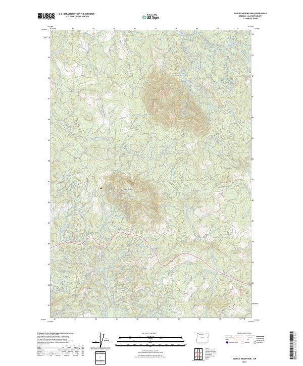
2023 Map of Saddle Mountain
USGS Topo · Published 2023About this map
Saddle Mountain State Natural Area anchors this landscape in the northern Oregon Coast Range, dominated by the peaks of Saddle Mountain and Humbug Mtn. The terrain is defined by a dense network of drainage systems, with the Necanicum River winding through the southwestern section and the Lewis and Clark River flowing westward. Further east, the West Humbug Creek and East Humbug Creek carve through the timberlands, eventually feeding into the larger coastal watersheds.
Find a feature on this map
27 named features on this map. Tap any name to fly to it.
Don’t see what you’re looking for? This feature index may not catch every label — zoom into the map to look around manually.
Map Details
Editions of this 2023 Saddle Mountain Map
This is the sole edition of this map. No revisions or reprints were ever made.
Other maps of this area

1919 · Astoria
USGS Topo · 1:62,500

1939 · Astoria
USGS Topo · 1:62,500

1939 · Saddle Mountain
USGS Topo · 1:62,500

1940 · Svensen
USGS Topo · 1:62,500

1940 · Cape Falcon
USGS Topo · 1:62,500

1943 · Saddle Mtn.
USGS Topo · 1:62,500

1948 · Vancouver
USGS Topo · 1:250,000

1949 · Green Mountain
USGS Topo · 1:24,000
1949 · Olney
USGS Topo · 1:24,000

1950 · Vancouver
USGS Topo · 1:250,000