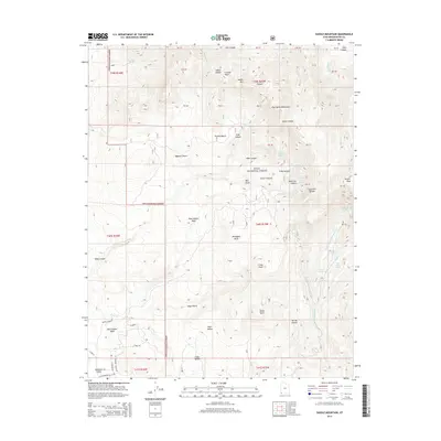
2014 Map of Saddle Mountain
USGS Topo · Published 2014About this map
Diamond Valley sits at the southwestern edge of this landscape, where residential development meets the steep eastern slopes of the Pine Valley Mountains. The topography is defined by dramatic elevation changes, rising from the Mojave Desert floor toward the high peaks of the Dixie National Forest. Notable summits like Saddle Mtn and Burger Peak overlook a complex network of drainages including Lark Canyon, Carter Canyon, and Reservoir Canyon. These canyons are fed by numerous high-altitude springs, such as Quaking Aspen Spring and Slide Canyon Spring, which form the headwaters of Forsyth Cr and Cottonwood Cr. On the lower benches, family-named landmarks and local infrastructure like Blake Gubler road and the Cedar Bench area highlight the intersection of private land and public forest. The presence of features like Truman Bench and Mahogany Knoll among the deeply incised washes of Rock Hollow Wash and Alger Gulch illustrates the transition between the arid desert basin and the alpine forest environment.
Find a feature on this map
107 named features on this map. Tap any name to fly to it.
Don’t see what you’re looking for? This feature index may not catch every label — zoom into the map to look around manually.
Map Details
Editions of this 2014 Saddle Mountain Map
This is the sole edition of this map. No revisions or reprints were ever made.
Other maps of this area

1885 · St. George
USGS Topo · 1:250,000

1891 · St. George
USGS Topo · 1:250,000

1953 · Cedar City
USGS Topo · 1:250,000

1954 · La Verkin 3 NW
USGS Topo · 1:24,000

1954 · St. George
USGS Topo · 1:62,500

1954 · Hurricane
USGS Topo · 1:62,500

1956 · St. George NW
USGS Topo · 1:24,000

1956 · St. George NE
USGS Topo · 1:24,000

1957 · New Harmony
USGS Topo · 1:62,500

1958 · Cedar City
USGS Topo · 1:250,000