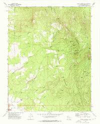
1972 Map of Saddle Mountain
USGS Topo · Published 1976About this map
Dixie National Forest dominates this 1972 survey, revealing a landscape defined by the high peaks and deep drainages of the Pine Valley Mountains. The topography is marked by a series of prominent high points, including Saddle Mountain and the towering Burger Peak, which overlooks a complex system of canyons and springs. Water sources are critical landmarks here, with locations like Quaking Aspen Spring, Big Pine Spring, and Lone Pine Reservoir providing vital points of reference across the high benches.
Find a feature on this map
47 named features on this map. Tap any name to fly to it.
Don’t see what you’re looking for? This feature index may not catch every label — zoom into the map to look around manually.
Map Details
Editions of this 1972 Saddle Mountain Map
This is the sole edition of this map. No revisions or reprints were ever made.
Other maps of this area

1885 · St. George
USGS Topo · 1:250,000

1891 · St. George
USGS Topo · 1:250,000

1953 · Cedar City
USGS Topo · 1:250,000

1954 · La Verkin 3 NW
USGS Topo · 1:24,000

1954 · St. George
USGS Topo · 1:62,500

1954 · Hurricane
USGS Topo · 1:62,500

1956 · St. George NW
USGS Topo · 1:24,000

1956 · St. George NE
USGS Topo · 1:24,000

1957 · New Harmony
USGS Topo · 1:62,500

1958 · Cedar City
USGS Topo · 1:250,000