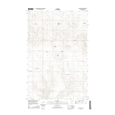
2014 Map of Saddle Rock
USGS Topo · Published 2014About this map
Saddle Rock stands as a prominent elevation in this northern Montana landscape, marking a terrain defined by deep erosional drainages known locally as coulees. The complex hydrological network includes the West Fork Black Coulee and East Fork Black Coulee, which converge as they carve through the arid high plains. This 2014 survey documents the enduring physical character of the region, where transportation is limited to a few arterial routes like Cow Island Rd and Cr-300. The land is meticulously organized by the Public Land Survey System, with township boundaries for t26n r17e and t26n r18e clearly delineated. This map provides a clear record of the watershed patterns around Bills Coulee and Volcano Cr, offering researchers a view of the remote ranching and grazing lands of Blaine County as they appeared in the early 21st century.
Find a feature on this map
14 named features on this map. Tap any name to fly to it.
Don’t see what you’re looking for? This feature index may not catch every label — zoom into the map to look around manually.
Map Details
Editions of this 2014 Saddle Rock Map
This is the sole edition of this map. No revisions or reprints were ever made.
Other maps of this area

1953 · Havre
USGS Topo · 1:250,000

1954 · Leroy
USGS Topo · 1:24,000

1954 · Lewistown
USGS Topo · 1:250,000

1956 · Maddux
USGS Topo · 1:62,500

1957 · Havre
USGS Topo · 1:250,000

1958 · Havre
USGS Topo · 1:250,000

1959 · Lewistown
USGS Topo · 1:250,000

1959 · Warrick
USGS Topo · 1:62,500

1964 · Ragland Bench
USGS Topo · 1:24,000

1964 · Chase Hill
USGS Topo · 1:24,000