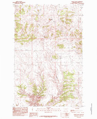
1985 Map of Saddle Rock
USGS Topo · Published 1985About this map
Saddle Rock rises as the primary landmark in this section of Blaine County, overlooking a landscape defined by an intricate network of drainages and coulees. The map, compiled from aerial photography in the late 1970s, captures a sparsely populated ranching or agricultural environment where natural watercourses like West Fork Volcono Creek and the East Fork dictate the layout of the land. Evidence of local industry or agricultural storage is localized at the Storage Bins found near the winding path of Black Coulee. The terrain is marked by seasonal or intermittent flows such as Bills Coulee, typical of the high plains of north-central Montana. This 1985 edition provides a technical look at the landforms and drainage patterns before modern digital mapping, reflecting the quiet, rural character of the region during the final decades of the twentieth century.
Find a feature on this map
6 named features on this map. Tap any name to fly to it.
Don’t see what you’re looking for? This feature index may not catch every label — zoom into the map to look around manually.
Map Details
Editions of this 1985 Saddle Rock Map
This is the sole edition of this map. No revisions or reprints were ever made.
Other maps of this area

1953 · Havre
USGS Topo · 1:250,000

1954 · Leroy
USGS Topo · 1:24,000

1954 · Lewistown
USGS Topo · 1:250,000

1956 · Maddux
USGS Topo · 1:62,500

1957 · Havre
USGS Topo · 1:250,000

1958 · Havre
USGS Topo · 1:250,000

1959 · Lewistown
USGS Topo · 1:250,000

1959 · Warrick
USGS Topo · 1:62,500

1964 · Ragland Bench
USGS Topo · 1:24,000

1964 · Chase Hill
USGS Topo · 1:24,000